Sitework takeoff, cut and fill from the grading plan.
Click the spot elevations on the grading plan and Kisheet reads them as existing and proposed grade, with cut and fill for any area. Paving, curb, pipe and erosion control come off the same sheets.
A sitework bid in Kisheet, step by step.
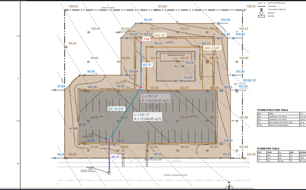
A grading and drainage plan for a branch bank pad: a parking lot draining to a valley, a drive-through lane, curbs, three inlets and a storm line to the street. Here is how it goes to cut and fill, paving, curb and pipe.
The drawings are a sample set made for this guide. Every picture is a real screenshot of Kisheet, pre-release build of October 21, 2026.
-
1
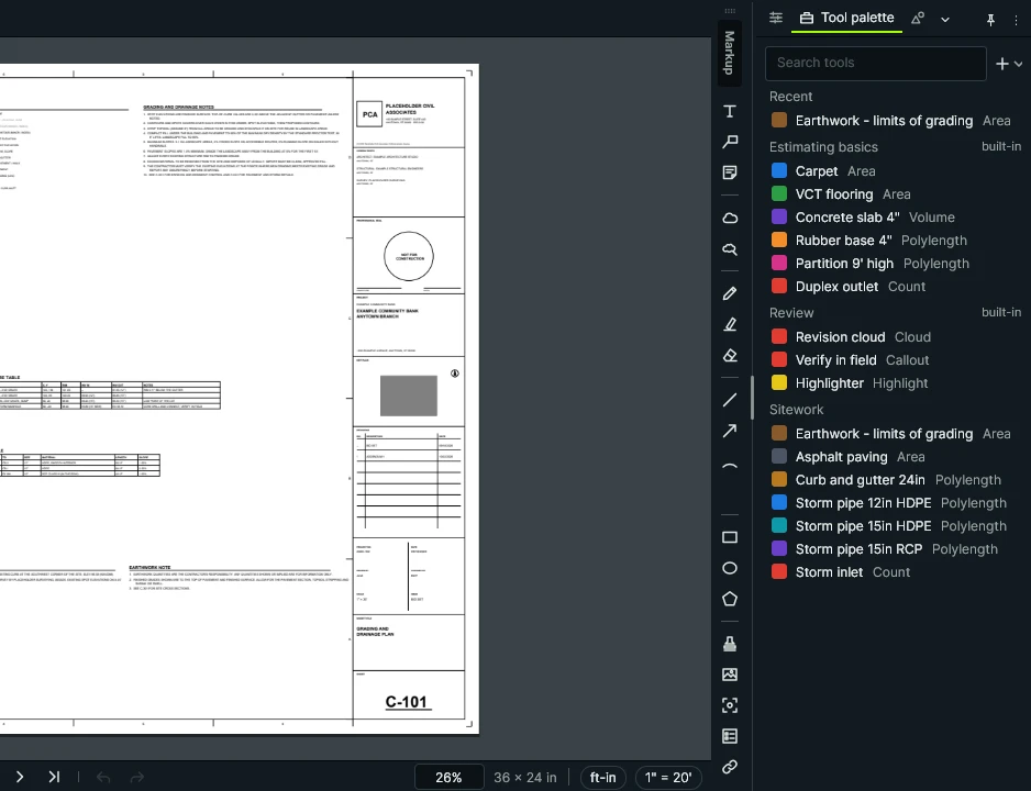
Make the site tools
Kisheet reads the 1" = 20' scale printed under the plan. One list makes the tools: the limits of grading and the asphalt as areas, curb and each pipe size as runs, the inlets as a count.
Tools › Measure › Use Printed Scale; Tools › Tool Sets › New Tool Set from Excel or CSV
Kisheet, October 21, 2026 -
2
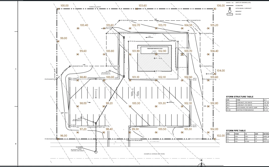
Existing ground from the survey spots
Turn on Existing Grade Spots and click each surveyed elevation on the plan. Kisheet reads the printed number under the click, so nothing is typed, and marks each spot.
Tools › Measure › Earthwork › Existing Grade Spots, then click each printed elevation
Kisheet, October 21, 2026 -
3
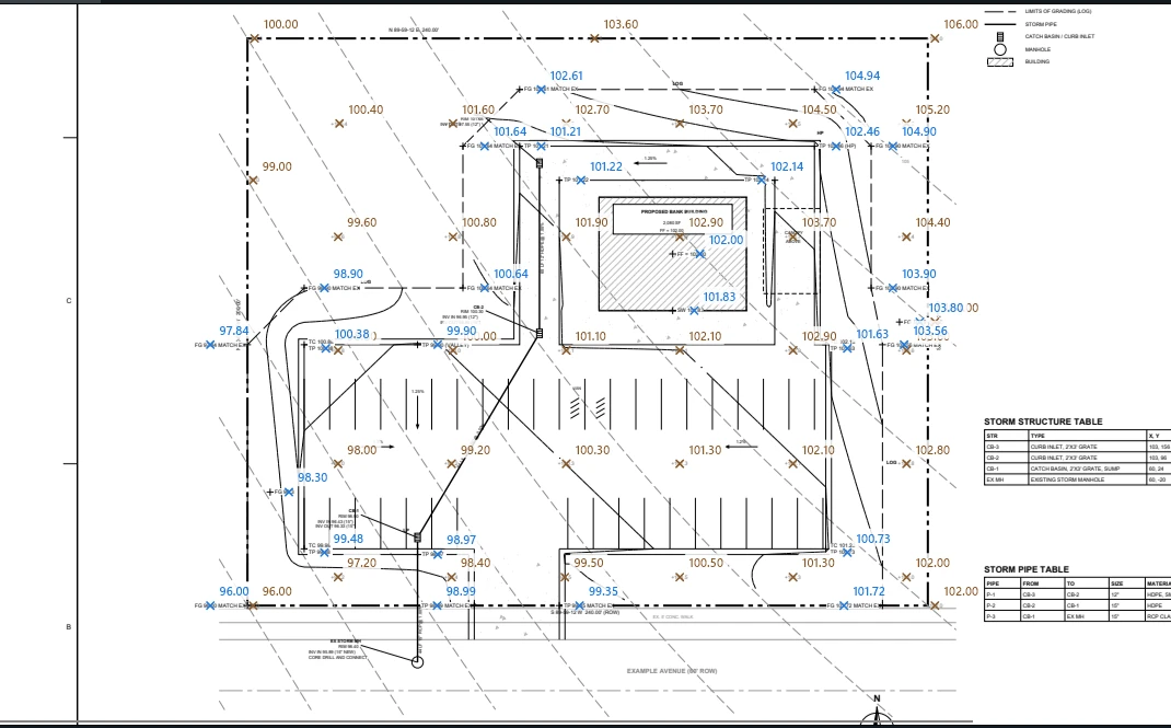
Proposed grade from the design spots
Then Proposed Grade Spots: click the top of pavement, sidewalk, finished floor and finished grade spots, and the match-existing spots along the limits of grading where the new grade ties back in.
Tools › Measure › Earthwork › Proposed Grade Spots, then click each printed elevation
Kisheet, October 21, 2026 -
4
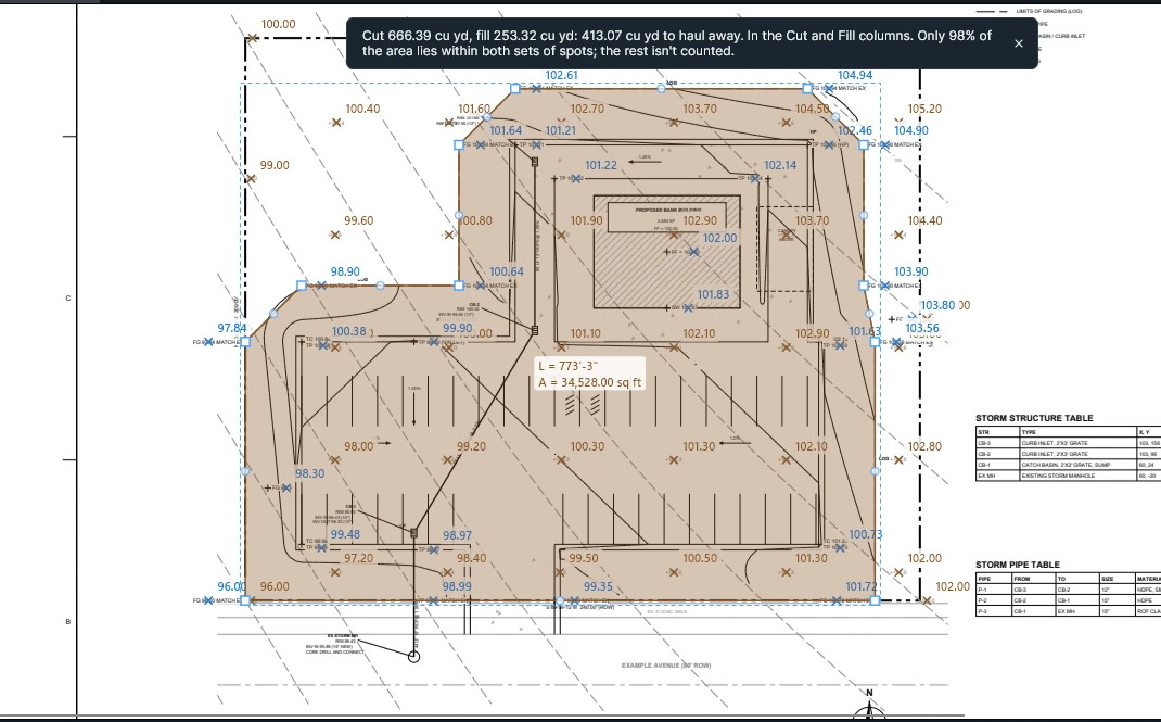
Cut and fill inside the limits of grading
Trace the limits of grading as an area and choose Cut and Fill for the Selected Area. Kisheet compares the two grounds over it and gives the cut and fill in cubic yards, and puts them in the takeoff table.
Draw the area, then Tools › Measure › Earthwork › Cut and Fill for the Selected Area
Kisheet, October 21, 2026 -
5
Paving, curb and storm pipe
Click the four corners of the parking lot for its asphalt, trace the curb round the lot and the island, then each storm pipe with the tool for its size and material, and count the three inlets.
Pick each tool, click the corners or along the run, double-click to finish
Kisheet, October 21, 2026 -
6
Read the totals
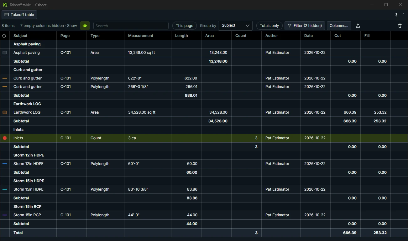
Group the takeoff table by subject and filter out the spot elevations: the cut and fill, the asphalt area, the curb and each pipe by length, and the inlet count.
Takeoff table › Group by › Subject, then Filter (here in its own window)
Kisheet, October 21, 2026
Built for how a sitework bid comes together.
Cut and fill on a PDF
Existing and proposed grade spots read from the printed elevations (EL, FF, TC, INV and plain numbers); cut and fill for any area in cubic yards, with the cells either surface doesn't reach reported.
Cross sections
Trace cut and fill areas on the section sheets and give each a station, such as 12+50: volumes between stations come by average end area.
Strip and import
Area × depth for topsoil. Order in cubic yards with a swell or shrink percent (25 for loose, −10 for compacted), so BCY, LCY and CCY stay labeled.
Paving
Square yards from the area; tons by density (about 2.0 tons per CY for asphalt), set per lift.
Curb, pipe and silt fence
Lengths by type; trace each depth band of a pipe as its own run.
Inlets and structures
Count them, or let Visual Search find every one.
Excel for your bid system
Export by item, ready to map to bid items.
A site tool set, ready on day one
Asphalt surface and binder, aggregate base, concrete paving, curb and gutter, striping, topsoil strip, cut and fill, RCP and HDPE storm, PVC sanitary, manholes, inlets, silt fence, sod and seed.
When you still want a 3D earthwork tool: Kisheet works from the 2D plan and section sheets: no surfaces from contour lines, mass haul or machine-control files. For those you still want a 3D earthwork tool.
A bid in six steps.
- Make the site tools
- Existing ground from the survey spots
- Proposed grade from the design spots
- Cut and fill inside the limits of grading
- Paving, curb and storm pipe
- Read the totals
Take off your next sitework bid in Kisheet.
One price for your whole company. Buy it once, or subscribe. Never per seat.
Other trades